Case study · Drone surveying & civil works
A credible digital home for an aerial surveying startup
DroneX Civil provides precision aerial mapping, photogrammetry and progress tracking for the construction and land-development industry across Melbourne and Victoria. ENGIS Studio built its first web presence: a single, fast-loading platform that presents real project work, embeds interactive 3D site models, and turns aerial capability into something a project manager can evaluate in a minute.
Starting point
Where things stood
- A new venture with the engineering capability, but no digital presence to prove it to prospective clients.
- Deep archives of drone imagery and photogrammetry data with nowhere to showcase them credibly.
- No clear way for a builder or developer to understand the services on offer and request a quote.
- A brand that needed to read as established and technical, not like a hobbyist with a drone.
Challenges
What made it hard
- Aerial services are abstract until seen — the site had to make capability tangible, fast.
- Photogrammetry deliverables are large and interactive; static images alone undersell them.
- A civil audience judges credibility quickly — the presentation had to feel engineering-grade.
- As a lean startup, the platform had to be inexpensive to run and simple to update without a developer.
Strategy
The transformation approach
- 01Lead with real work: a featured-projects gallery drawn from actual sites like Chirnside Park and Hardys Road.
- 02Make the data interactive — embed navigable 3D photogrammetry models so visitors can explore a real site themselves.
- 03Structure the offer around four clear services and a four-step engagement process, so intent converts to enquiry.
- 04Build on a lightweight static-hosting stack with a self-managing contact form to keep running costs near zero.
Key improvements
What was built
Capability-led homepage
CompletedAn aerial hero and a clear value proposition establish credibility above the fold, tuned for a civil and land-development audience.
Real featured-project galleries
CompletedMulti-image project cards for Chirnside Park, Hardys Road, May Road and Lewis Street present genuine site work with context, not stock imagery.
Interactive 3D site models
CompletedNavigable photogrammetry models embedded via Sketchfab let visitors rotate and zoom a real reconstructed site directly in the page.
Structured services & process
CompletedFour defined services and a four-step briefing-to-delivery process turn abstract aerial capability into a concrete, comparable offer.
Self-managing enquiry path
CompletedA spam-filtered contact form routes enquiries straight to the business inbox with no third-party service or ongoing fee.
Brand, social and launch assets
CompletedA consistent logo, LinkedIn and Instagram presence, and launch collateral rolled out alongside the site.
Additional 3D model hosting
In progressMigrating the larger May Road photogrammetry model to hosted streaming so every flagship site is explorable in 3D.
Technical implementation
Under the hood
- Static HTML/CSS/JS
- Netlify hosting & Forms
- Squarespace domain / DNS
- Sketchfab 3D embeds
- RTK drone photogrammetry data
- Responsive, mobile-first build
Gallery
The transformed experience
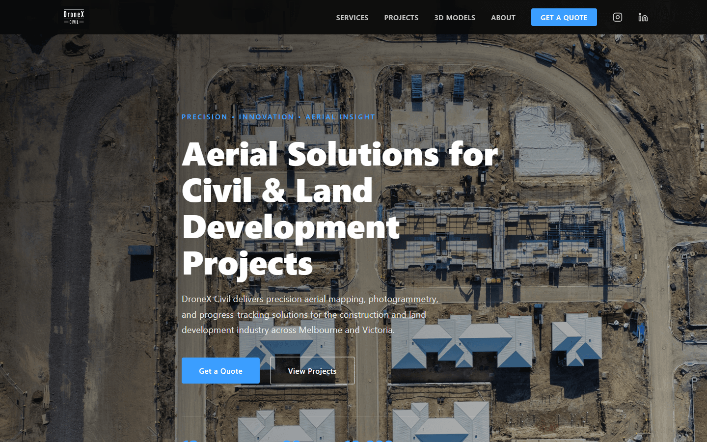
Homepage — capability established above the fold. 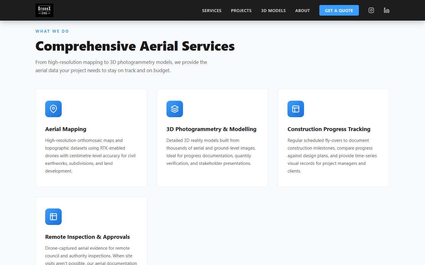
Four clearly structured aerial services. 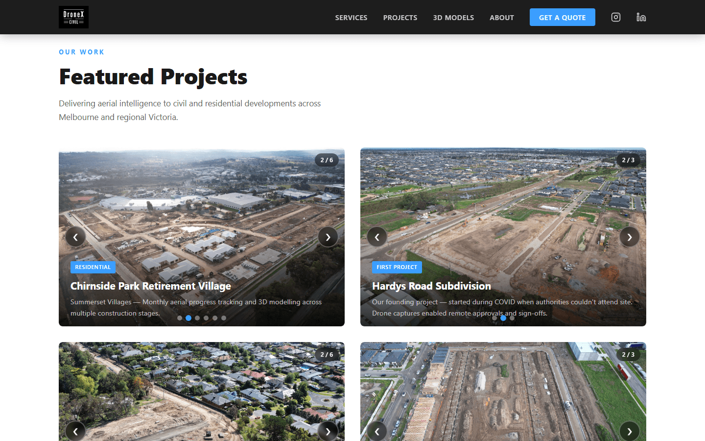
Featured projects — real site work, with context. 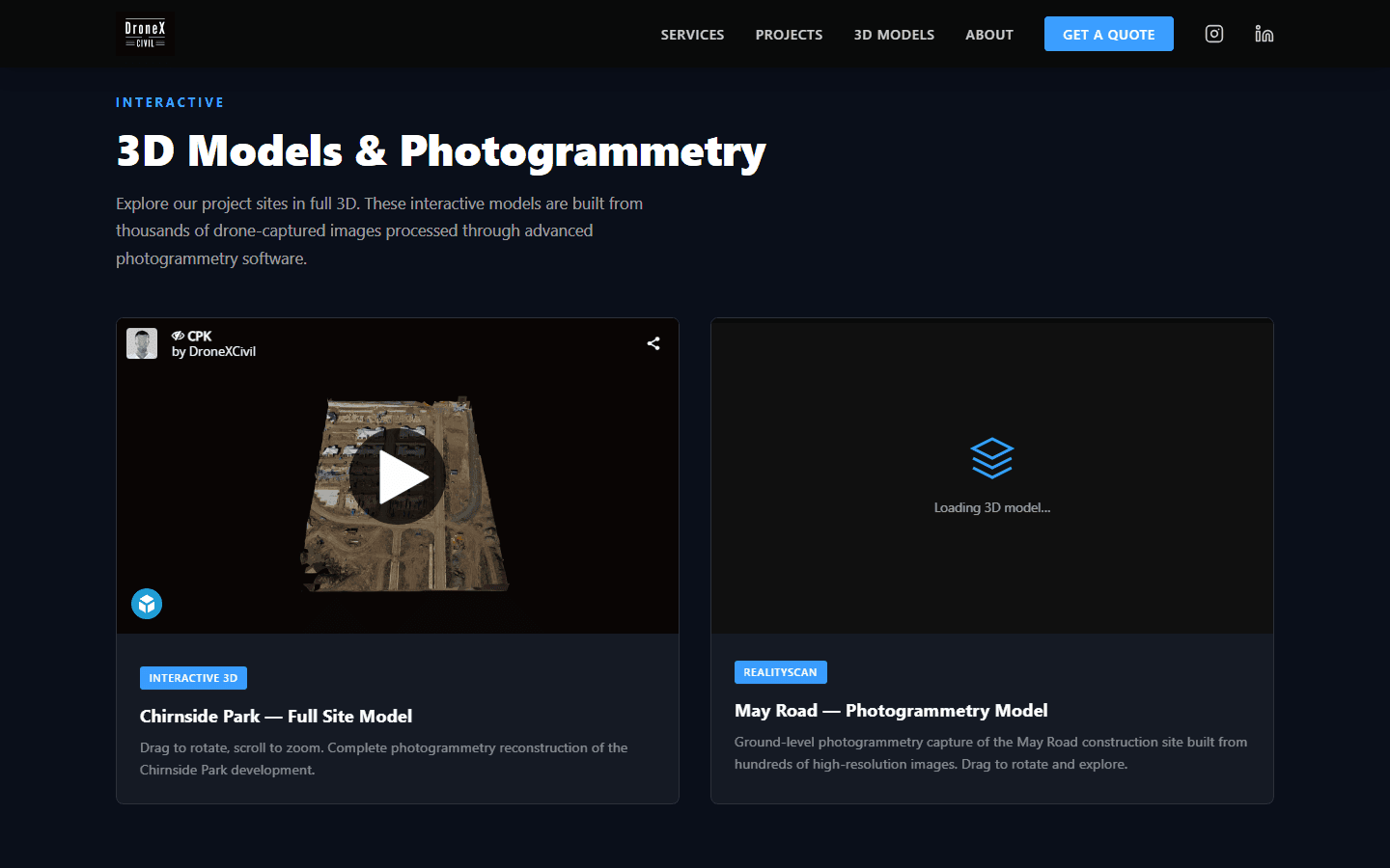
Interactive 3D photogrammetry models, embedded in-page. 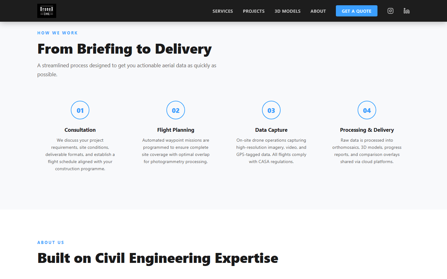
A four-step briefing-to-delivery process. 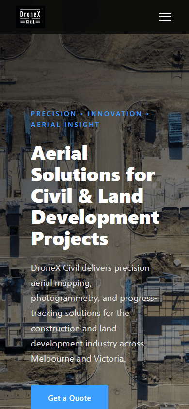
Mobile-first — credible on any device.
What changed
The outcome for the business
- DroneX Civil now has a credible digital front door that matches the quality of its fieldwork.
- Prospective clients can explore real projects and interactive 3D site models before making contact.
- Enquiries arrive through a structured form instead of being lost across ad-hoc channels.
- The platform runs at minimal cost and the owner can update projects and imagery without a developer.
Next
Where it can go from here
- A per-project 3D model library as more sites are flown and processed.Proposed
- A client portal for progress-tracking deliverables and time-series comparisons.Proposed
- Case-study write-ups per project to deepen search visibility and credibility.Future opportunity